
 Back
A practical beginner’s guide to Real-Time Kinematic positioning, GNSS corrections, and precision applications.
Everyday GPS is excellent for navigation, but some jobs demand more precise positioning. A surveyor measuring a point, a tractor following crop rows, or a drone mapping a site may need accuracy measured in centimeters rather than meters. Real-Time Kinematic (RTK) is a GNSS positioning technique that helps make this possible under suitable conditions.
What is RTK?
RTK stands for Real-Time Kinematic. It uses measurements from GNSS satellites together with correction information from a reference station or network to calculate a precise position. GNSS includes GPS, Galileo, GLONASS, BeiDou, and other satellite navigation systems.
In plain English: satellites tell a receiver where it is approximately; RTK uses additional measurements and corrections to calculate where it is much more precisely. An RTK-capable receiver is required—corrections alone do not turn a phone into a survey-grade device.
Why is ordinary GPS not always accurate enough?
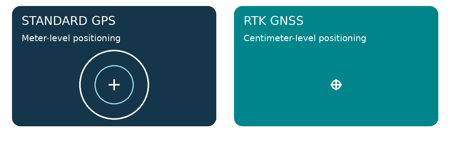
Satellite signals can be affected by atmospheric delays, orbit and clock errors, reflected signals, and limited visibility of the sky. A few meters of uncertainty may be fine for road directions, but not for recording a survey point or repeating a machine path.
How does RTK work?
A GNSS reference station at a known location observes satellite signals. The network uses reference observations to provide correction data. An RTK rover combines those corrections with its own satellite measurements and processes carrier-phase information to calculate a high-precision position.
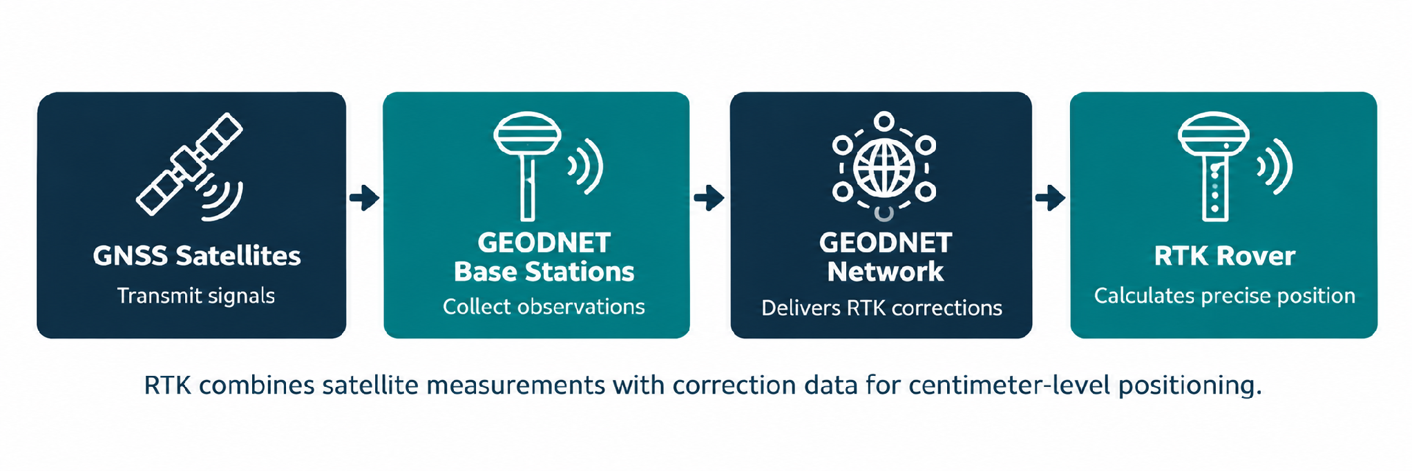
GEODNET delivers compatible RTK correction streams over the internet using NTRIP. For more on that delivery method, see Article #1: “What Is NTRIP? How It Works for RTK GPS.”
How accurate is RTK GPS?
GEODNET describes achievable RTK precision of approximately 1–2 cm under suitable conditions. Actual results depend on receiver quality, satellite visibility, antenna setup, correction latency, baseline distance, and interference. Vertical accuracy can differ from horizontal accuracy, and a receiver’s estimated precision is not a guarantee of absolute accuracy.
For important measurements, verify results against known control points and follow the standards appropriate to the project.
RTK Fixed vs. RTK Float—explained
- RTK Fixed — The receiver has resolved the required carrier-phase ambiguities. This is generally the preferred status for centimeter-level work.
- RTK Float — The receiver is using carrier-phase observations but has not fully resolved the ambiguities. Precision is usually lower and less predictable.
- Standalone GNSS — The receiver calculates its position without RTK corrections, generally with meter-level uncertainty in typical open-sky conditions.
Do you need your own RTK base station?
Not necessarily. A local base station is one option, but network RTK services let compatible rovers receive corrections from an existing reference-station network. GEODNET provides subscription-based correction access in supported areas, reducing the need for users to install and maintain their own local base station.
Where is RTK used?
- Surveying and mapping — Collect field coordinates and support topographic or site mapping workflows.
- Precision agriculture — Support machine guidance and repeatable planting, spraying, and field operations.
- Drones and aerial mapping — Improve aircraft positioning and georeferencing in compatible mapping workflows.
- Construction — Support layout, stakeout, and machine-control applications.
- Outdoor robotics — Provide precise positioning inputs for autonomous machines alongside other sensors.
What equipment do you need for network RTK?
You generally need an RTK-capable GNSS receiver, compatible correction-service access, an NTRIP client, and a cellular or Wi-Fi connection. You should also check local network coverage, correction format, and coordinate reference frame compatibility.
How GEODNET fits in
GEODNET operates a decentralized network of GNSS reference stations. Its network page describes standard NTRIP delivery, RTCM 3.2 correction streams, and achievable 1–2 cm RTK precision under suitable conditions. GEO-MEASURE is a handheld RTK GNSS rover that connects to its mobile app via Bluetooth LE and it includes 1-year Free GEODNET RTK corrections.
- Explore the GEODNET RTK Network
- Explore GEO-MEASURE Handheld GNSS RTK Receiver
- Explore GEO-MEASURE + Carbon Fiber Survey Pole Bundle
Frequently asked questions
Ready to put centimeter-level positioning to work?
Explore GEODNET’s RTK correction network, confirm coverage, and choose a compatible receiver for your application.